
Aponia GPS Navigation
Aponia GPS Navigation screenshots (14)


Description Aponia GPS Navigation
A Comprehensive Navigation Engine for the Demanding User
Aponia GPS Navigation positions itself as a utility-focused alternative to mainstream mapping services, prioritizing offline functionality and granular route control. This application is engineered for users who require reliable guidance in areas with poor connectivity or who prefer a more data-transparent and customizable navigation experience. It operates as a standalone tool, separating itself from the social and advertising integrations common in larger platforms.
Core Functionality and Analytical Overview
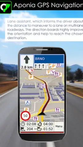
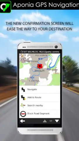
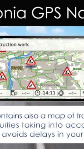
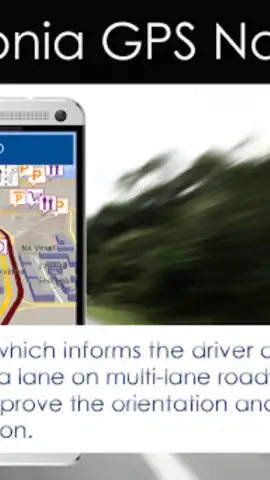
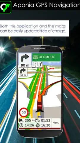
The application’s primary operational mode is built around pre-downloaded vector maps, which are stored locally on the device. This allows for full GPS navigation without an active internet connection, consuming mobile data only for optional real-time traffic updates. The routing engine provides multiple profile options, including driving, cycling, and pedestrian modes, each with configurable parameters. Users can set custom waypoints and avoid specific road types, offering a higher degree of route planning than basic turn-by-turn applications. The interface presents a clear, uncluttered view of the route, speed, and estimated time of arrival, with audible alerts for upcoming maneuvers.
Key Technical and Usability Advantages
The principal advantage of this software is its self-contained operation, making it a dependable tool for international travel or rural exploration without incurring roaming charges. The map management system is logical, allowing users to download specific countries or regions, conserving device storage. Performance is consistent, with a focus on battery efficiency during prolonged use. The absence of intrusive banners or pop-up ads contributes to an uninterrupted navigation session, which is a notable differentiator in this category.
- Fully Offline Global Navigation with downloadable, detailed vector maps for entire countries or regions.
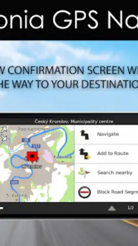
- Customizable Route Planning with adjustable vehicle profiles and avoidances for tolls, highways, or ferries.
- Clear, Data-Efficient Display showing speed, altitude, remaining distance, and ETA without visual clutter.
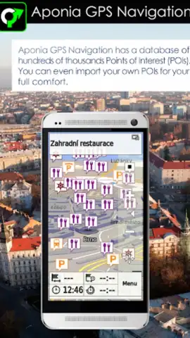
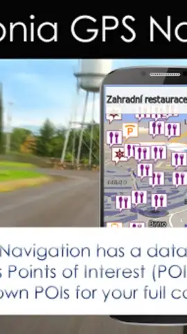
- Integrated Points of Interest (POI) Search for finding fuel stations, restaurants, and accommodations offline.
- Regular, Free Map Updates to ensure road network changes and new points of interest are reflected.
Download Aponia GPS Navigation now for unrestricted, ad-light route planning. Exclusive, early access to the latest regional map packs is available for the first wave of new users.
Internet required for initial map downloads and traffic data. IAP available.


