Garmin ActiveCaptain®
Garmin ActiveCaptain® screenshots (12)
Description Garmin ActiveCaptain®
Need to connect your on-board Garmin chartplotter with your smartphone for a smarter day on the water? Garmin ActiveCaptain® is the dedicated mobile platform that creates this vital link, transforming your compatible mobile device into a powerful command center and planning tool for maritime activities. This application facilitates a seamless flow of data, charts, and community intelligence between your phone and your Garmin marine network, whether your focus is cruising, fishing, sailing, or diving. It is engineered not as a standalone navigation app, but as an integrated ecosystem enhancer designed to elevate the functionality of your existing Garmin hardware with advanced management, planning, and monitoring capabilities.
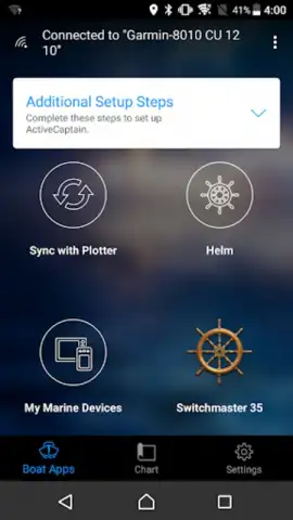
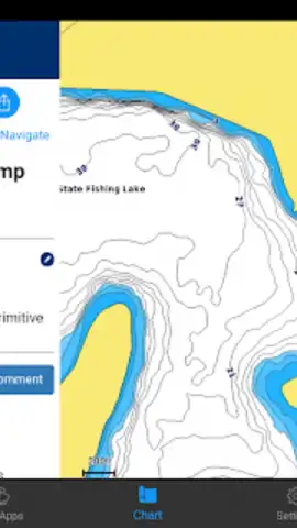
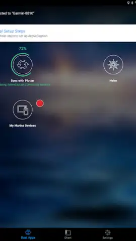
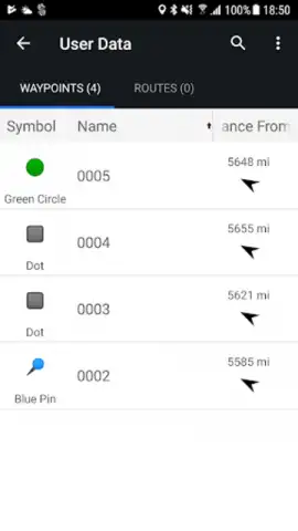
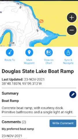
The core functionality revolves around wireless synchronization. The app enables the direct transfer of detailed charts and software updates to your compatible Garmin chartplotter, eliminating the need for physical cards or cables. Comprehensive trip planning can be conducted from your mobile device using integrated tools; routes and waypoints created are then wirelessly sent to the plotter. The platform serves as a gateway to the expansive ActiveCaptain community database, providing user-generated data on marinas, boat ramps, hazards, and local points of interest to inform decision-making. For vessel management, the system extends to remote monitoring and control through specific subscription services, allowing for oversight of critical systems from a distance.
Core Feature Set
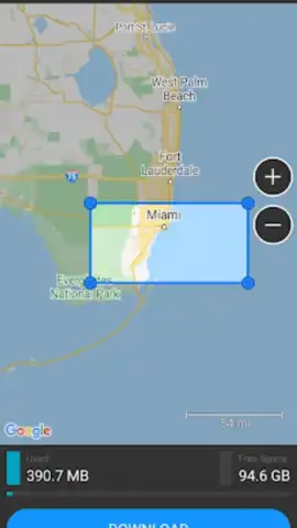
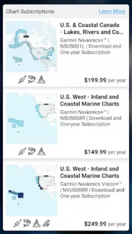
- Wireless Chart & Data Transfer: Sync detailed BlueChart® g3, NOAA raster charts, and software updates directly to your Garmin chartplotter via your mobile device.
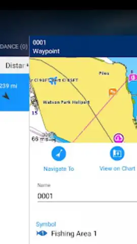
- Integrated Trip Planning Tools: Plan routes, mark waypoints, and explore new destinations on your phone before syncing the entire plan to your boat's navigation system.
- ActiveCaptain Community Access: Read and contribute to crowd-sourced data for marinas, anchorages, hazards, and local knowledge directly within the app.
- Remote Vessel Monitoring (OnDeck™): With a subscription, monitor bilge status, battery voltage, security alerts, and location tracking from your smartphone.
- Direct Chartplotter Notifications: View smartphone call and message alerts on your chartplotter screen, keeping your device stored and your attention forward.
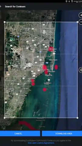
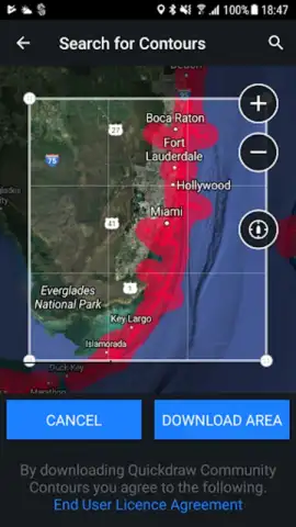
The application provides access to next-generation cartography through ONECHART™, where users can purchase Garmin Navionics+™ and Navionics Vision+™ charting for enhanced coverage and detail. The Helm™ remote control function allows for operating the chartplotter's cursor and menus directly from your mobile device, offering convenience while navigating. Integration with the Garmin Quickdraw™ community grants access to high-definition contour maps created by users and enables you to contribute your own sonar data. All your app data, including saved trips and community notes, is automatically backed up and synced across your registered devices, ensuring your information is preserved. The interface is designed to centralize control, giving you a single point for managing your chartplotter's functions, reviewing community insights, and overseeing vessel systems when configured.
Download the Garmin ActiveCaptain® app now and unlock the full potential of your Garmin marine electronics. Connect, plan, and monitor with unprecedented convenience directly from your smartphone.
Download mobile app now!
Technical Disclaimer: This application requires a compatible Garmin chartplotter and a stable internet connection for full functionality, including data sync, community features, and updates. It is not intended for use as a primary, standalone navigation tool. Certain advanced features, including OnDeck™ remote monitoring and some premium chart layers, require separate purchases or subscriptions. Data usage rates may apply when downloading charts or syncing over cellular networks. Always verify critical navigation information using official sources and primary onboard instruments. Use of the app while operating a vessel must comply with local maritime regulations.


