
Google Earth
Google Earth screenshots (11)

Description Google Earth
Ever Wondered What Your House Looks Like From Space?
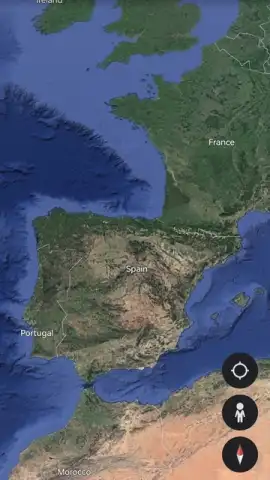
Imagine holding the entire planet in your hands, able to zoom from a view of the swirling globe down to the roof of your own home in seconds. That’s the daily reality with Google Earth. This isn’t just a map; it’s a living, breathing digital model of our world, built from millions of high-resolution satellite and aerial images. You feel the thrill of exploration without a passport, satisfying your curiosity about any corner of the Earth from the deepest rainforest canyons to the peaks of the Himalayas, all through an interface that feels intuitive and magical.
A World of Detail at Your Fingertips
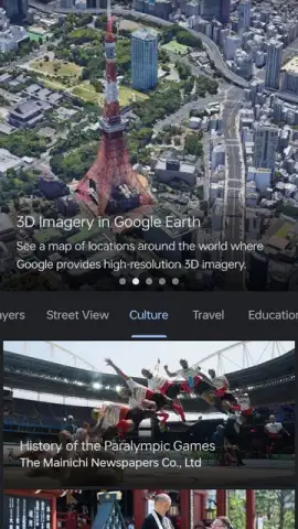
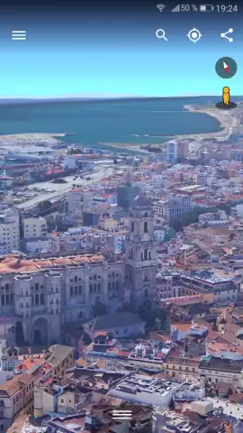
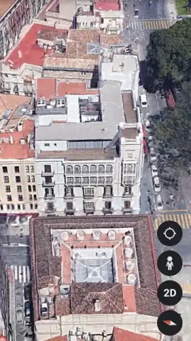
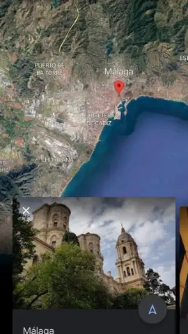
The core experience is built on stunning 3D rendering technology that reconstructs entire cities, natural landscapes, and geographical features in immersive detail. You don’t just look at a flat picture of the Eiffel Tower or the Grand Canyon; you tilt and glide around them in three dimensions, examining them from every angle as if you were flying. This sense of presence is transformative, making distant landmarks feel accessible and real.
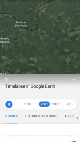
One of the most powerful tools is the Timelapse feature. By navigating through the layers section, you unlock decades of satellite imagery in sequence. Watch coastlines erode, forests expand, and megacities rise from the ground, witnessing profound environmental and urban change unfold right before your eyes. It’s a poignant, data-driven story of our planet’s evolution.
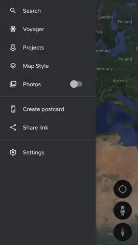
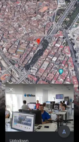
For personal use, the application becomes your digital exploration notebook. You can drop placemarks on your dream destinations, draw lines to plan future road trips, or polygon areas for study. These custom maps can be enriched by adding your own photos and videos directly onto the landscape, creating layered, personal guides that are far more meaningful than a simple screenshot.
The seamless integration of Street View is a game-changer for ground-level exploration. You can transition seamlessly from a satellite view to standing on a street in Tokyo, looking around in 360 degrees. Furthermore, the tool includes live data layers, such as real-time aircraft tracking, letting you follow flights across the globe and understand the constant motion of our world.
The "Voyager" section is your curated guide to discovery. Here, you’ll find interactive tours, articles, and educational videos crafted by storytellers and scientists. These journeys teach you about diverse cultures, wildlife, history, and geography, turning aimless browsing into a learning adventure every time you open the app.
- Globe-Trotting 3D Exploration: Navigate a fully rendered 3D planet with detailed city models, mountains, and oceans.
- Historical Imagery Timelapse: Observe the dramatic change of any location on Earth over decades with a powerful time slider.
- Personalized Map Creation: Annotate the world with custom placemarks, paths, and your own multimedia content.
Download Google Earth for Android Now
Stop imagining and start exploring. Claim your free, front-row seat to the entire planet and unlock a new perspective on your world today.
Heads up: you'll need wifi for most features to load high-resolution imagery and 3D data smoothly. Some cool stuff, like certain guided Voyager tours, may be updated or expanded over time.


