
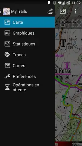
MyTrails
MyTrails screenshots (15)
Description MyTrails
Transform Your Outdoor Navigation with a Professional-Grade GPS Tool
MyTrails is engineered as a comprehensive navigation platform for serious outdoor enthusiasts, delivering a professional mapping experience directly to your mobile device. It eliminates the friction of typical free apps by providing a completely ad-free interface and seamless functionality, whether you are hiking, cycling, running, skiing, or orienteering. This application consolidates advanced GPS tracking, detailed cartography, and deep performance analytics into a single, robust tool designed for reliability in any environment.
Core Functionality and Technical Capabilities
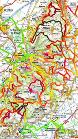
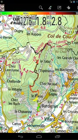
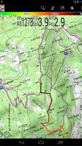
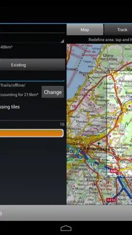
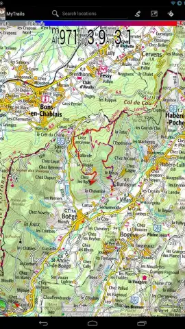
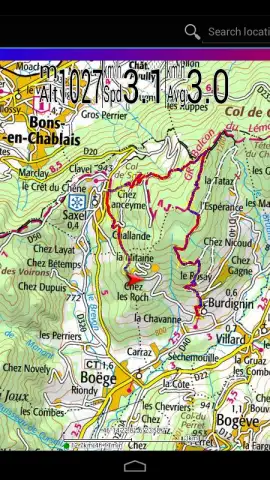
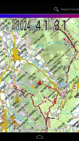
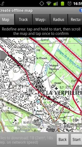
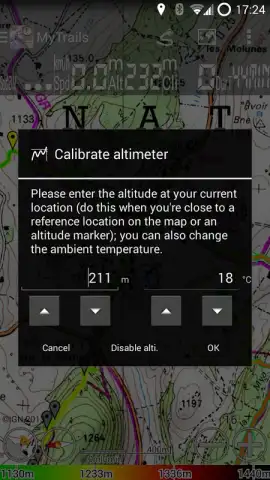
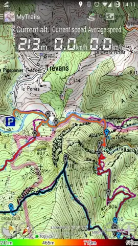
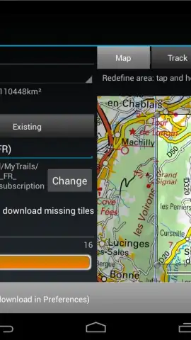
The application operates on high-precision topographic maps, available through in-app purchase, which include specialized formats like marine charts for coastal navigation. A defining technical feature is the full offline mode, which allows users to download and store vector-based map tiles locally on the device. This process not only ensures uninterrupted access in areas without cellular signal but also optimizes battery consumption and eliminates mobile data usage. Map rendering is hardware-accelerated, maintaining flawless clarity and smooth panning even when displaying complex routes with thousands of track points.
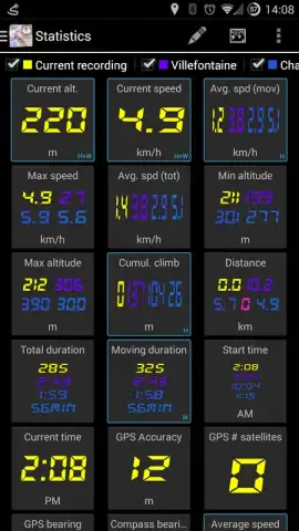
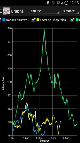
Navigation is enhanced by an automatic map orientation system that uses the device’s built-in compass and GPS to rotate the full-screen map in real-time according to your direction of travel. For data analysis, the platform offers over 40 distinct statistical metrics—such as speed, elevation gain, pace, and distance—which can be monitored live on a customizable dashboard, overlaid directly on the map, or viewed on an Android Wear device. Users can record detailed GPS tracks and, in the Pro version, display multiple tracks simultaneously in different colors for direct comparison of historical routes.
Detailed Feature Overview
- Premium Offline Cartography: Download and store high-resolution topographic, marine, and satellite maps locally for full functionality without an internet connection, conserving battery and data.
- Advanced Performance Analytics: Track and visualize over 40 real-time statistics with configurable graphs and detailed elevation profiles to analyze every aspect of your outdoor activity.
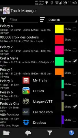
- Multi-Platform Synchronization: Plan routes on a tablet and sync data seamlessly to your phone via Dropbox, ensuring all your maps and tracks are updated across all devices.
Additional utility features include gesture-based controls, like a three-finger swipe to switch between map layers and a pull-down gesture to activate a head-up display (HUD) for quick statistic viewing. Pro users gain the capability to publish and share their recorded routes directly to platforms like My Trails and import routes created by others. The software is fully optimized for tablet displays, providing a spacious interface for meticulous trip planning before exporting the data to a handheld device for use in the field.
Start navigating with precision and access deep performance insights today.
Download mobile app now
Internet required for initial map downloads. In-app purchases available.


