
Oskemenbus
Oskemenbus screenshots (7)


Description Oskemenbus
Navigating Public Transport in Oskemen: A Practical Analysis
Reliable public transit information is a cornerstone of efficient urban mobility, yet accessing accurate schedules and real-time vehicle locations can often be a challenge. Oskemenbus addresses this directly as a dedicated navigation utility for the city of Oskemen, providing a consolidated digital toolset for bus, tram, and minibus (marshrutka) services. This review examines its operational mechanics and feature set to determine its utility for daily commuters and occasional travelers alike.
Core Functionality and Route Planning Mechanics
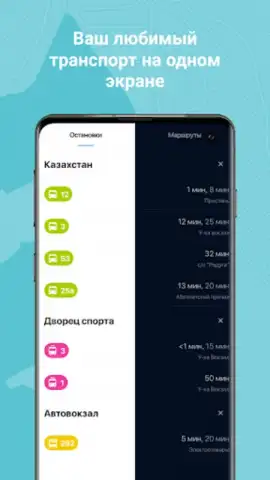
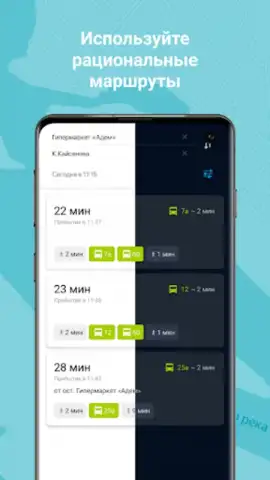
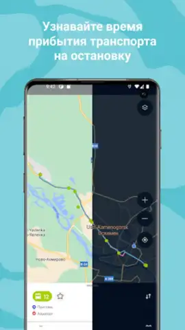
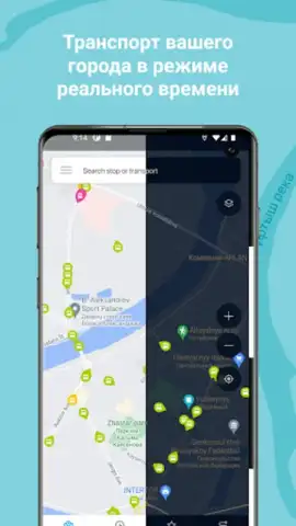
The application operates on a foundation of real-time GPS data and integrated schedules. Its primary interface is an interactive map that displays all active public transport vehicles, with distinct visual markers for different transport types. For route planning, users can input a start point—either via GPS detection, a selected bus stop, or a manual map pin—and a destination. The system then processes available routes, accounting for all connected modes of transport to calculate and suggest the most viable paths. This planning module is designed to factor in walking segments to and from stops, presenting a complete door-to-door itinerary rather than just the transit portion.
Real-Time Tracking and Operational Data
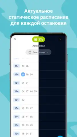
Beyond static schedules, Oskemenbus provides a live tracking layer. Each vehicle on the map transmits its position, direction, and speed, enabling the app to compute estimated times of arrival (ETAs) for upcoming stops with a notable degree of precision. The system is configured to push instant notifications in the event of significant service delays or route deviations, alerting users to potential disruptions. Furthermore, the app maintains and updates information on route terminuses and any last-minute changes to final stops, ensuring that planning data reflects the current operational state of the transport network.
Customization and User-Centric Tools
The utility includes several features for personalization to streamline frequent use. Users can bookmark specific stops or entire routes as favorites, creating a personalized quick-access dashboard within the app. The map view itself is filterable, allowing individuals to declutter the display by hiding specific transport types or highlighting only their saved favorite routes. This focus on configurable information display ensures that users are presented with relevant data, reducing cognitive load during planning. The absence of advertising within the core interface supports an uninterrupted user experience.
- Comprehensive multi-modal support for city buses, trams, and minibuses (marshrutkas) on one map.
- Live vehicle tracking with GPS-based positioning and movement direction for all active units.
- Intelligent journey planner that calculates optimal routes including necessary walking segments.
- Real-time arrival countdowns and instant push notifications for service delays or changes.
- Fully customizable interface with favorite stops, route filtering, and ad-free core navigation.
For residents and visitors in Oskemen who require dependable, real-time public transit information, this application provides a focused and functional toolkit. We suggest trying Oskemenbus for its detailed tracking and planning capabilities, which are specifically calibrated for the local transport network.
Download the Oskemenbus mobile app now.
The application requires an active internet connection for real-time features and map data. Functionality is subject to the availability of data from local transport services.


