
OsmAnd
OsmAnd screenshots (9)


Description OsmAnd
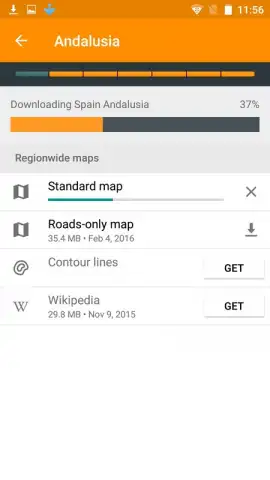
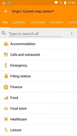
Looking for a map and navigation app that gives you complete control over your data and works anywhere on Earth, even without a signal? OsmAnd delivers detailed, worldwide maps by leveraging the collaborative power of OpenStreetMap (OSM), storing them directly on your device for true offline independence. This approach ensures you have reliable geographic information at your fingertips, from city grids to remote trails, without relying on a live data connection. The application requires you to download regional map files, which provides unparalleled access but necessitates managing local storage space for larger areas.
Core Functionality and Data Integration
Beyond standard vector maps, OsmAnd integrates points of interest (POI) with descriptive information sourced directly from Wikipedia. This layer transforms the app from a simple navigator into a dynamic travel guide. As you move, you can pull up concise entries about nearby monuments, museums, parks, and restaurants, providing immediate cultural and practical context for your surroundings. This feature is particularly valuable for planning walking tours or discovering hidden local gems without needing to switch between multiple applications.
Version Comparison and Advanced Tools
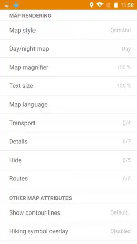
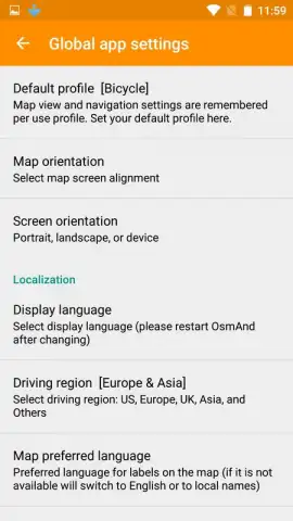
The free version of OsmAnd offers robust offline mapping and basic navigation but includes limitations, such as a cap on the number of downloadable maps and the absence of the integrated Wikipedia POI layer. Upgrading to the paid OsmAnd version removes these restrictions, allowing for unlimited map downloads and management entirely within the app. The premium tier unlocks extensive customization options, letting you alter the map's visual style for better clarity and choose between specific navigation modes—including a traditional compass view, a fixed bearing orientation, or a dynamic view that rotates with your direction of travel.
Comprehensive Offline Navigation System
The app's primary utility is its fully offline navigation system for driving, cycling, and hiking. It provides turn-by-turn voice guidance, altitude and distance tracking, and the ability to plot routes avoiding specific road types like ferries or motorways. For outdoor activities, it supports specialized map rendering for topographic details and can display GPX tracks. The system is designed for functionality, offering configurable speed warnings, lane guidance for complex intersections, and a dashboard widget for quick route access.
- Global offline OpenStreetMap access
- Wikipedia POI and travel guide data
- Fully offline voice navigation
- Unlimited custom map downloads (Premium)
Don't wait to equip your device with a truly independent navigation toolkit. Download OsmAnd now and explore with confidence, completely offline!
Heads up: you'll need wifi for initial map downloads. Some cool stuff, like unlimited downloads and Wikipedia points of interest, is extra in the paid version.


