
Satfinder: Satellite Director
Satfinder: Satellite Director screenshots (7)


Description Satfinder: Satellite Director
A Practical Guide to Satellite Dish Alignment
For anyone who has attempted to manually align a satellite dish, the process of finding the correct azimuth and elevation is often a trial-and-error endeavor involving repeated adjustments and signal checks. Satfinder: Satellite Director addresses this core challenge by converting a smartphone into a dedicated satellite alignment instrument. It functions by processing your precise GPS coordinates against an integrated database of over 150 orbital satellites to calculate and visually present the exact positioning data required for optimal signal acquisition. This method shifts the setup from guesswork to a measured, technical procedure.
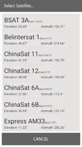
Core Technical Capabilities and Interface
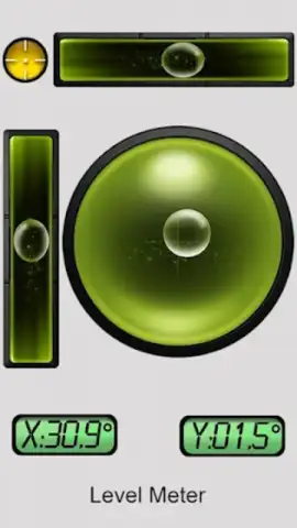
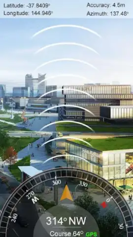
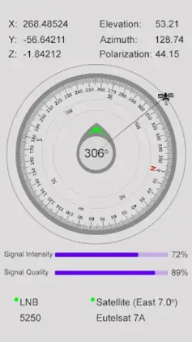
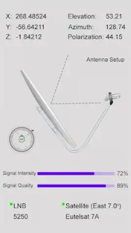
The application’s primary utility is delivered through a combination of traditional navigation tools and augmented reality (AR) visualization. The standard display provides essential numerical readouts for azimuth, elevation, and LNB skew specific to your selected satellite. For physical alignment, a built-in digital inclinometer and compass provide real-time feedback. The defining feature, however, is the AR overlay mode, which projects the orbital path and current position of satellites directly onto a live camera view of the sky. This creates a direct visual target for alignment. An additional haptic feedback mechanism activates a vibration alert when the device is oriented within the precise directional parameters of the chosen satellite, confirming correct positioning without requiring constant visual reference to the screen.
Beyond the alignment process, the app serves as a technical reference database. It includes a satellite orbital view, illustrating the satellite's position relative to your location on Earth, which aids in understanding potential signal obstructions. The integrated channel frequency finder provides detailed transponder lists, broadcasting standards, and channel information for each satellite, turning the tool from a simple aligner into a comprehensive satellite system planner. The interface is structured to separate basic functions from advanced tools, allowing both casual users and professional installers to navigate its features efficiently.
- Augmented Reality Sky Overlay: Projects real-time satellite trajectories onto your camera view for intuitive visual targeting and alignment.
- Precision Alignment Toolkit: Integrates a digital compass, azimuth/elevation calculator, and spirit level with haptic confirmation for accurate physical adjustment.
- Comprehensive Satellite Database: Accesses technical data for over 150 satellites, including transponder frequencies, channel lists, and orbital position views.
The tool is engineered for field use in diverse environments, from urban settings with complex sight lines to remote areas where precise orientation is critical. By consolidating multiple instruments into one device, it standardizes the setup process and reduces the time and physical effort typically associated with satellite dish installation and fine-tuning.
Start installing with precision today and claim your advantage now.
Internet required. IAP available.


