
SeTracker2
SeTracker2 screenshots (4)
Description SeTracker2
A New Standard for Location Tracking and Family Safety
SeTracker2 establishes itself as a comprehensive and reliable platform for real-time location monitoring and geofencing, designed specifically for managing family safety and tracking valuable assets. It moves beyond basic map functionality to offer a connected ecosystem where location data transforms into actionable insights and peace of mind. This application addresses the core need for discreet, accurate, and immediate awareness of the whereabouts of loved ones or important items, directly from your primary mobile device.
Core Functionality and Analytical Tools
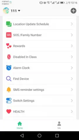
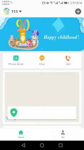
The application operates by pairing with dedicated GPS tracking hardware, such as children's smartwatches or personal locators, to stream continuous location data to your smartphone. The interface presents this information on a detailed, interactive map with multiple view modes, from standard street maps to satellite imagery for precise contextual understanding. A primary mechanic is the creation and management of customizable safe zones, or geofences, around key locations like home, school, or a workplace. The system provides instant push notifications the moment a tracked device enters or leaves these predefined areas, enabling proactive rather than reactive monitoring. Furthermore, the app maintains a detailed history of routes and locations, which can be reviewed to analyze patterns over hours, days, or weeks, offering valuable long-term insight into routines and travel paths.
Key Operational Advantages
The utility of SeTracker2 is amplified by its focus on user experience, reliability, and depth of information. The design prioritizes a clear, uncluttered dashboard where critical information—current location, battery level of the connected device, and alert status—is accessible at a glance. Performance is centered on stable, low-latency data transmission to ensure that location updates are timely and accurate, a non-negotiable aspect for safety-focused applications. The visual presentation of data, from the color-coded geofences on the map to the clean timeline of historical movements, is designed for immediate comprehension without sacrificing detail.
- Real-Time Location Monitoring: View precise, live GPS positions of connected devices on an interactive map with periodic auto-refresh.
- Customizable Safe Zone Alerts: Define circular or polygonal geofences and receive instant notifications for boundary crossings.
- Detailed Location History & Playback: Review past routes with a timeline slider to replay the entire path and stop points of any tracked day.
We suggest trying SeTracker2 if you require a robust, intuitive solution for keeping digital tabs on family members or valuable possessions with clarity and control.
Internet required. IAP available.


