
GPS Test
GPS Test screenshots (6)

Description GPS Test
Ever Wondered What Your GPS Actually Sees?
GPS Test cuts through the guesswork, transforming your phone into a professional-grade satellite diagnostics tool. It’s for anyone who needs more than just a blue dot on a map—whether you’re hiking in remote terrain, testing signal strength for work, or simply curious about the complex satellite network overhead. This app delivers a live technical readout of every satellite in view, giving you unprecedented control and understanding of your true position, signal quality, and environmental data.
Core Technical Capabilities
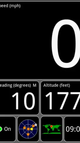
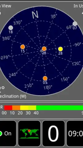
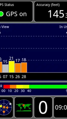
The interface presents a dashboard of real-time telemetry across several dedicated screens. The primary screen aggregates your essential GPS fix data, including precise latitude and longitude, altitude above sea level, and the critical signal-to-noise ratio (SNR) for each satellite, which is the definitive metric for signal purity and strength. A dedicated satellite compass view plots each satellite's azimuth and elevation on a radial chart, color-coded by signal strength, allowing you to visually identify which satellites are providing your strongest signals and where weak spots or obstructions may lie.
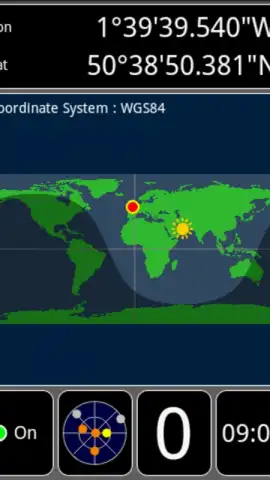
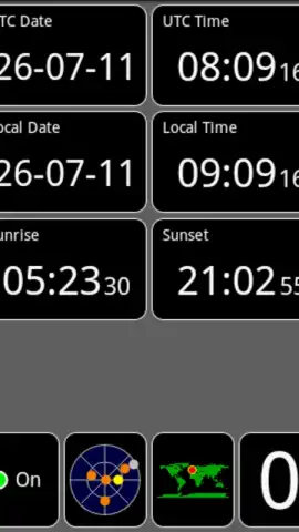
Your positional data is visualized on an interactive map with your exact coordinates, accompanied by a dynamic global sun indicator that shows the current line of daylight and darkness across the Earth. For navigation, a comprehensive movement panel displays your precise ground speed, direction of travel (bearing), and a detailed track log. The app also serves as a field information hub, providing local date and time, sunrise and sunset calculations for your exact coordinates, and current weather data pulled for your location.
Key Features at a Glance
- Live satellite SNR and compass
- Precise coordinates and altitude
- Speed, bearing, and track logging
- Global sunlight terminator map
- Sunrise, sunset, and local weather
- No advertisements in Turbo mode
We suggest trying GPS Test to gain a technical edge in navigation, planning, and understanding your device's capabilities. Consider downloading it now to see the invisible network that guides you.
Heads up: you'll need wifi or a data connection for map tiles and weather data. Some advanced features and the ad-free Turbo experience are part of the premium offering.


