
Live Earth Map & GPS Tracker
Live Earth Map & GPS Tracker screenshots (5)
Description Live Earth Map & GPS Tracker
Your World, Live and Connected: The Ultimate Real-Time Exploration Tool
Stop looking at static maps. The Live Earth Map & GPS Tracker app transforms your device into a dynamic global viewfinder and a powerful safety companion, merging high-definition live satellite imagery with precise, real-time location tracking. This isn't just another navigation utility; it's a comprehensive platform for adventurers, families, and curious minds to explore every corner of the planet and stay meaningfully connected with their circle. By seamlessly integrating live camera feeds, interactive 3D terrain models, and a unique social tracking feature, it delivers a multifaceted experience that is as practical for daily commutes as it is profound for global discovery.
Core Functionality and User Experience
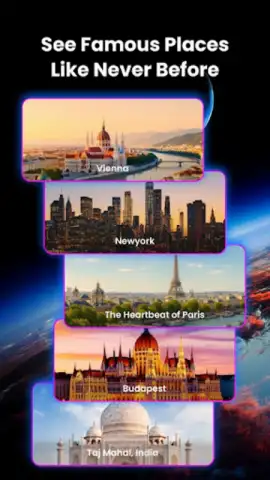
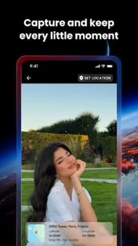
The application's foundation is built on a robust GPS and mapping engine that provides multiple layers of geographical data. Users can instantly switch between standard map views, detailed satellite overlays, and immersive 3D models that render cities and natural landscapes with striking topographical accuracy. The live Earth view function pulls from a network of global cameras, offering real-time visual feeds from iconic landmarks and bustling streets worldwide, allowing for virtual tourism and trip planning with unprecedented realism. For personal navigation, the toolset includes route plotting with turn-by-turn guidance, destination previews, and the ability to drop custom geotags to document and save points of interest, creating a personalized digital travel log.
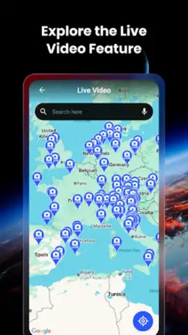
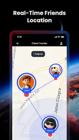
Real-Time Social Tracking and Safety Integration
A defining feature of this platform is the dedicated Friend Tracker system. This secure network allows users to create private groups by sharing unique connection codes. Once linked, you can view the live, updated locations of friends or family members directly on the interactive global map, alongside the public camera feeds. This functionality serves dual purposes: it facilitates effortless meet-up coordination in crowded areas and provides a layer of safety monitoring for loved ones during travel, commutes, or outdoor adventures. It operates as a private social tool that prioritizes peace of mind without public broadcasting.
Uninterrupted Exploration with Turbo Mode
The app offers an enhanced operational mode that removes all advertising banners and interstitial promotions. Activating this mode streamlines the interface, accelerates map loading times, and provides priority access to high-resolution satellite imagery and camera streams. This ensures a fully immersive, distraction-free experience whether you are meticulously planning a hiking route, monitoring a child's journey home from school, or simply exploring live views of a distant cityscape.
- Live Satellite & Camera Views
- Real-Time Friend Location Tracker
- Interactive 3D Maps & Geotagging
Download the Premier Live Mapping Experience Today
This application redefines what a modern mapping tool can be, merging exploration with connection. Don't rely on outdated, passive maps. Gain access to a living, breathing digital globe and a private safety network. For a limited time, new users can experience premium features with exclusive initial access. Transform how you see the world and connect with your people.
Download the Live Earth Map & GPS Tracker mobile app now to start your live exploration.
Disclaimer: This application requires a stable internet connection for live satellite views, camera feeds, and real-time tracking features. Certain advanced functionalities and the ad-free experience may require an in-app purchase. Continued use of GPS running in the background can dramatically decrease battery life.


