
AlpineQuest GPS
AlpineQuest GPS screenshots (4)
Description AlpineQuest GPS
Lost in the wild? Your phone just became your ultimate guide.
Ever felt that thrill of heading off the beaten path, only to be followed by a tiny pang of worry about finding your way back? You check your phone, but the standard map is just a blank, useless grid once the trail ends. That's where your adventure truly begins, and where AlpineQuest GPS steps in. This isn't just another map app; it's a professional-grade topographic navigation tool built for the moments when you leave the ordinary world behind. Whether you're scaling a rocky face, navigating dense hunting grounds, or catching the wind on a sailing trip, this app transforms your device into a powerful survival and logging companion that works precisely where you need it most.
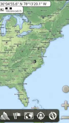
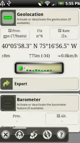
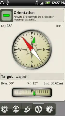
Imagine having a detailed, terrain-revealing topographic map permanently on your device. AlpineQuest GPS puts that power in your pocket, showing your exact position as a moving dot on a rich, informative landscape. You’re not just seeing a road; you’re seeing elevation contours, ridge lines, and valleys. The integrated digital compass keeps you oriented, while the precise coordinate readout gives you your latitude, longitude, and current altitude at a glance—no more guessing. Every peak you conquer and every hidden lake you discover is logged with pinpoint accuracy.
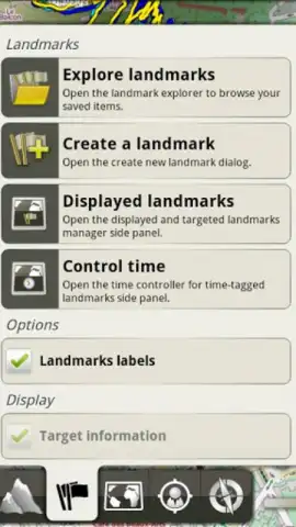
But AlpineQuest GPS understands that an adventure is a story to be recorded and shared. You can drop custom landmarks on your virtual map to mark that perfect camping spot, a tricky trail junction, or your secret fishing hole. These markers stay put, creating your personal trail of breadcrumbs through the wilderness. Later, you can export all this journey data or share your routes and points of interest with fellow adventurers with just a few taps. The app then becomes your personal logbook, compiling deep statistics from your outing. It doesn't just track you; it analyzes your journey, showing total distance, max altitude reached, time spent moving, and more, turning a day outside into a dataset of personal achievement.
With its straightforward, intuitive interface, AlpineQuest GPS is designed for use when your focus needs to be on the environment, not on a complicated screen. It’s the reliable tool for hikers, climbers, explorers, and anyone who finds their peace far from cell towers.
Here’s what makes AlpineQuest GPS your essential outdoor partner:
- Navigate with confidence using detailed, offline topographic and satellite maps.
- See your real-time position, altitude, and coordinates with integrated compass guidance.
- Mark and save important locations with customizable landmarks and area indicators.
- Review comprehensive post-trip stats like distance, elevation gain, and duration.
- Export your journey data or share your routes and waypoints seamlessly.
Stop wishing for a better guide and start trusting one. Transform your next excursion from a venture into the unknown into a confidently tracked expedition. Get the tool that professional adventurers rely on.
Download AlpineQuest GPS now and never question your path again!
Heads up: you'll need to download maps via wifi for full offline use. Some premium map sources and advanced features may require additional in-app purchases.


