
Yango Maps
Yango Maps screenshots (9)


Description Yango Maps
Imagine you're navigating a complex multi-level interchange in a new city, with the sun setting and traffic building. Instead of confusion, you hear a calm, precise voice guiding you through each lane change, while your map glows with real-time traffic flowing like rivers of light. This is the daily reality with Yango Maps, a comprehensive GPS navigation platform engineered to transform every journey—whether by car, foot, or bus—into a seamless experience. It goes beyond basic point-to-point directions to become an intelligent travel companion, deeply integrated with the urban fabric of cities like Dubai and Baku, helping you discover not just the fastest route, but the smartest one.
Core Navigation & Intelligent Routing
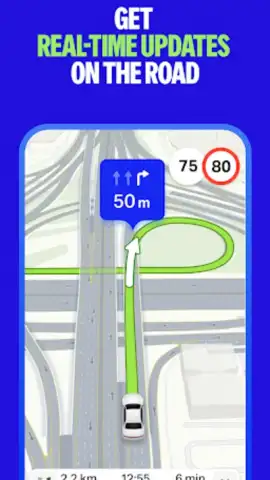
At its heart, Yango Maps provides ultra-precise turn-by-turn navigation for drivers. The system processes live data to dynamically recalculate paths, helping you avoid traffic jams, road closures, and sudden slowdowns. It offers detailed visual and audio guidance through challenging road layouts, including tunnels, intricate roundabouts, and multi-level flyovers, with clear warnings for speed cameras and speed limit changes. For pedestrians, the app builds optimized walking routes that consider pathways and shortcuts unavailable to vehicles, while the public transport module delivers accurate, updated schedules for buses and other transit options, complete with departure times and walking segments to stations.
Advanced Features for Exploration and Convenience
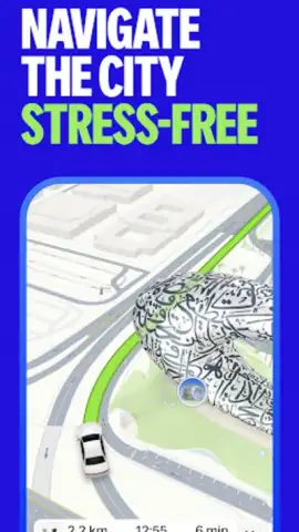
The app enhances exploration with visually rich, detailed 3D city maps. Key landmarks, such as the Burj Khalifa and the Dubai Frame, are rendered with distinctive lighting effects that capture their architectural presence, making visual orientation intuitive and engaging. A fully integrated taxi-hailing service is accessible directly within the app, allowing you to book a ride without switching applications. Furthermore, Yango Maps supports offline map downloads, enabling full-featured navigation and search in areas with poor or no internet connectivity. For drivers, compatibility with Android Auto projects the streamlined interface directly onto your car's display for safer, hands-free operation.
Comprehensive Travel Toolkit
Yango Maps functions as a unified dashboard for all urban mobility needs.
- Live Traffic-Avoiding Navigation: Receives constant updates on congestion, accidents, and roadworks to suggest the fastest driving routes in real time, complete with lane guidance and complex junction previews.
- Offline Map Accessibility: Download detailed maps of entire cities or regions to use turn-by-turn navigation, search for points of interest, and get directions without an active internet connection.
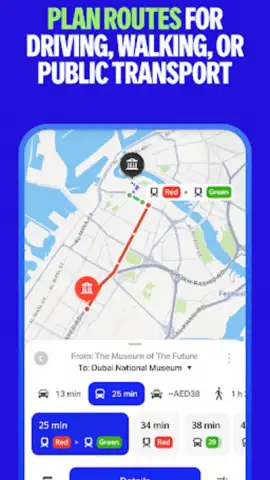
- Multi-Modal Journey Planning: Seamlessly combines driving, walking, and public transport steps into a single, efficient route, providing schedules, walking distances, and estimated fares for complete trip logistics.
We suggest trying Yango Maps for your next urban adventure or daily commute. Its blend of precise, real-time navigation and powerful auxiliary features like offline maps and integrated taxi service makes it a remarkably robust tool for confident travel. Consider downloading it to experience a smarter way to move through the city.
Download the Yango Maps mobile app now.
Please note: Certain features, such as live traffic updates, online search, and taxi booking, require an internet connection. The app may contain in-app purchases for additional services or an ad-free experience.


